Let’s Examine How Tides Affect Boating

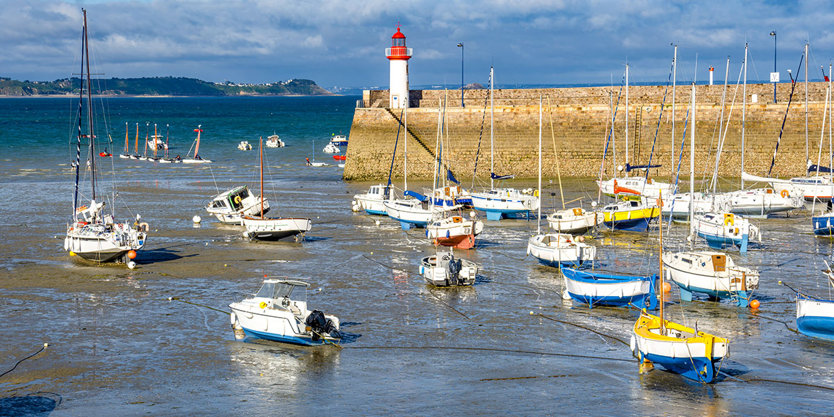
A lot of people wonder how tides affect boating. And it’s a legitimate concern. The real question, though, is: How do the tides not affect boating? It’s so easy to underestimate the power of the tides. But they should be just as much a factor in route planning as the wind and the weather. The trick is learning how these forces of nature interact, figuring out how tides affect boating.
Tides are one of the most reliable phenomena in the world. Get a handle on them and you will gain the upper hand in navigational route planning and will be a better boater in the end.
What Is the Tide?
Tides are the regular rise and fall of sea levels caused by the gravitational pull of the moon and the sun, combined with the earth’s rotation. These movements follow predictable patterns, influencing coastal environments and navigation.
Most coastal areas experience semidiurnal tides. Say what? That just means there are two high tides and two low tides every 24 hours and 50 minutes. Each tidal phase takes about six hours and 12 minutes, so about 12 hours and 25 minutes to go from one high tide to the next low tide.
The sun has less gravitational pull on the ocean than the moon. But when the sun is in alignment with the moon, it can increase the tide, which creates a king tide. A king tide is sometimes referred to as a spring tide, which has no affiliation with the spring season. The term is in reference to a ‘springing forth.’ When the sun is perpendicular to the moon, the tides are more moderate, referred to as a neap tide.
Tide Versus Current
It can be easy to confuse the tide with the current. Current is a continuous flow of water in one direction (usually horizontal). The tide is one of many factors—wind, temperature, Coriolis Effect, geography are others—that can influence the water’s current. It is one of the most significant contributors.
Tidal Strength and Timing
The tide is dynamic, with forces changing regularly based on the magnitude of water moving. High tide is when water will reach its maximum level along the shore. Low tide is when water reaches its minimum level along the shore. Slack tide is a short period between the end of one tidal phase and the beginning of the next. Also known as ‘slack water,’ this is when the water’s horizontal movement is at its weakest.
Each of these tidal variations carries different forces behind the water moving. The 50/90 rule is a good rule of thumb for understanding how these forces can affect your boat’s movement on the water.
The 50/90 rule states the following:
- You can expect negligible flow speed as the tidal stream changes direction (slack tide).
- One hour later, the flow attains 50 percent of its maximum speed.
- Two hours after slack tide, the flow attains 90 percent of its maximum speed.
- Three hours after slack water, the flow speed is at 100 percent.
- That diminishes to 90 percent at four hours after slack tide.
- It again measures 50 percent at five hours after slack tide.
- Slack tide will occur again six hours after the initial slack tide
The higher the speed of the tidal flow, the stronger the current will be. Slack tide is the golden ticket. If you are planning on doing anything sticky, such as docking a boat or going through a dicey inlet, try to do it at slack tide. Conversely, if you are trying to make good headway on your route, plan to go when the tide is in your favor.
Complex Variables
When dealing with anything other than a singular body of moving water, it can be difficult to predict the patterns and figure out how tides affect boating. Remember what I mentioned above: Tidal strength changes based on the magnitude of water moving. You read about the flow speeds, which can alter the strength of tidal current. Other factors that influence the strength of water flow is geography and waterways converging.
Narrow Waterways
If a large body of water is moving through a narrow channel, you can expect the constriction of water to increase the speed of the flow. This geographic variable will become another dynamic factor in your calculations.
Depths
Similar to narrow waterways, shallow water can have an effect on the force of the tide. The Chesapeake Bay is a good example. A large influx of water moves into the large but shallow bay with the tide. This powerful flow into shallow waters can kick up a nasty sea state when it collides with the wind.
Complex Waterways
Some places on the IntraCoastal Waterway (ICW) are riddled with rivers, inlets, bays, and more. It can be almost impossible to predict tidal currents around the complex inland waterways. Aqua Map and Navionics are good resources for trying to understand the tidal flow of water in a particular area. Make sure you know how to decipher the icons and symbols on the app before trusting it to help plan your route. I can’t tell you how many times I have gotten it wrong and ended up in a less-than-pleasant situation.
When complex waterways are involved, tides and currents are not always the same. Know how to use your apps and other resources to figure out what you’re up against. Let them be your ally in figuring out how tides affect boating.
How the Tide Affects Docking
Depending on the tidal range and force, the tide can have a massive effect on docking. In Beaufort, North Carolina, the tidal flow in Taylor Creek packs a mighty punch. The harbor master at the Beaufort Docks played a nasty joke on me. He directed me to park next to Miniskirt, a $5 million sailing yacht more than 100 feet long, on the farthest inside slip available. I had to push through a tidal current of more than 3 knots while navigating an obstacle course to my slip.
At least seven Miniskirt crewmembers in matching clothes watched as I came inches from their spotless wax job. It was not my first time boating in the area. I had seen the current toss many boats around as they were trying to dock. But I succeeded.
Knowing what the tide is doing is essential while docking a boat. If you dock at slack tide, the tide will be negligible. But that doesn’t mean you won’t have to contend with other forces, including the wind and other boaters. Whenever possible, minimize any variables that can contribute to boat-docking-shame. When in doubt, point your vessel into the current to maintain better control.
How the Tide Affects Anchoring
Last year, we prepared to weather a blow behind Staniel Cay in the Bahamas. Being one of the few protected anchorages in the area, it was packed with boats. In a catamaran with minimal draft, we were able to find a spot to anchor in shallow water. In the middle of the night, the wind made an unexpected shift coinciding with low tide. We had about 50 feet of chain out, and so we swung 50 feet into shallower water when the wind shifted.
Simultaneously, the water was at its peak low tide. We bumped bottom, and then we floated off. Again. And again and again until the next morning. We crashed into the shore all night long.
Why didn’t we pull up the anchor and move? Our windlass decided to stop working at the same time. The wind was blowing too hard to pull up the anchor with our hand crank. We had to wait until morning to fix the windlass before we could pull up the anchor and find a more suitable anchorage. If I’ve learned anything on boats it’s this: trouble comes in pairs.
Before anchoring your boat, know your location’s tidal range and then equate the lowest range with any possible swing direction of your boat. In places such as Georgia, the tidal range can be close to 10 feet. And in Maine, it can be more than 20 feet.
You need to know if the tide is going to go up or down, and by how many feet. Then, put out your rode based on the highest level the tide will be during your stay.
If you are anchored in 7 feet of water at high tide with a tidal range of 6 feet, that will leave you only a foot of water at low tide. It might even be less if you and your boat end up swinging into shallower water when the current shifts.
These are just some of the ways that the tide can affect your boat while anchoring. And further examples of how tides affect boating overall.
Using the Tide to Navigate Inlets
A few years ago, my husband and I sailed out of Beaufort Inlet in what we believed to be the ‘perfect conditions.’ We assumed that going out of an inlet on a falling tide would offer a smooth exit. But that falling tide was facing more than 15 knots of wind. The waves were relentless, stacking higher and closer together as the wind collided with the tide. The bow of the boat could barely rise out of the trough before we were faced with another wall.
We rode that broken carnival ride one crashing wave at a time until we finally made it to deeper water. This is what happens when wind and tide collide. The Beaufort Inlet is notoriously rough, earning its nickname “the Washing Machine.” This same inlet sank Queen Anne’s Revenge as Black Beard tried to sail into Beaufort.
The tide isn’t the only factor to consider when approaching an inlet. If it were, it would be like walking on a conveyor belt at the airport; either the right way or the wrong way. Safely navigating inlets means understanding how the tide interacts with other forces present.
The Best Tool
The best tool to know how tides affect boating is experience. While you are acquiring this tool in your belt, be prepared as best you can. Utilize as many resources as possible. I used a combination of waterway guides, anchoring guides, large paper charts, and digital charts. All these resources helped me to understand the power of water moving in specific areas.
A word to the wise: Don’t get too comfortable. Your confidence might be in full bloom, with the sun shining and the wind at your back. But you should still have an idea of local geography and tidal currents that could impact your travel.
It doesn’t take much to shake your confidence right down to a pile of sand. The best way to keep that from happening is to stay prepared with the proper knowledge of local waterways.
Olivia de Soria